SOUTHERN ASIA · REGION GUIDE

Everest Region

Everest Region is not a single summit but a chain of Sherpa villages, Buddhist monasteries, glacial valleys and high passes shaped by trade and mountaineering.

Book

Escapes Itineraries

Every trip we run through Everest Region, including the ones that pass through on a longer route.

No trip runs here on its own yet

Read on — the guide below is the place, not the catalogue. Or tell us your dates and we will build one.

Ask about Everest Region

Tell us

No trip here yet

We have not put a Everest Region trip on the shelf yet, which is not the same as not going. Tell us what you want to see and how long you have, and your trip manager builds one around it.

Plan a Everest Region trip

A person reads it and replies — no automated quote, and nothing to pay to ask.

Understand Everest Region

The Story of Everest Region

The Khumbu is more than a route to Everest: Namche Bazaar, Tengboche Monastery and centuries-old Sherpa trade links explain how people live at extreme altitude.

Chapter 01 · ORIGIN

Migration across the high passes

Khumbu took shape as Sherpa families migrated from eastern Tibet around the 15th and 16th centuries, crossing passes such as Nangpa La and settling along the Dudh Kosi. Their villages linked trans-Himalayan trade with high-altitude farming, while Tibetan Buddhism supplied monasteries, chortens and the sacred geography that still orders the route.

Fact The name Sherpa derives from Tibetan words commonly interpreted as “eastern people,” reflecting migration from Kham towards Khumbu.

Chapter 02 · PEOPLE

Sherpa life beyond mountaineering

Sherpa society developed around villages, seasonal herding and Tibetan Buddhist institutions such as Tengboche Monastery. After Tenzing Norgay and Edmund Hillary climbed Everest in 1953, guiding, lodge ownership and expedition logistics expanded rapidly. Tourism now supports much of Khumbu, but household fields, monastery festivals and clan networks remain visible along the main trails.

Fact Mani Rimdu is performed at Tengboche Monastery according to the Tibetan lunar calendar, usually during October or November.

Chapter 03 · FOOD

Food shaped by altitude and trade

Thin soils above Namche Bazaar favoured barley, buckwheat and, after potatoes spread through Khumbu in the 19th century, a dependable high-altitude staple. Salt and wool once came over Nangpa La; rice and lentils moved up from Nepal’s lowlands. That geography explains menus pairing Sherpa stew and Tibetan-style momos with dal bhat suited to long trekking days.

Fact Rikikur, a Sherpa potato pancake, reflects the crop’s 19th-century adoption across Khumbu’s high fields.

Chapter 04 · ARCHITECTURE

Monasteries built for a seismic landscape

Khumbu architecture follows the authority of Tibetan Buddhist monasteries and the limits of local materials. Tengboche Monastery, founded in 1916 by Lama Gulu, uses painted timber, stone walls and a broad assembly hall. Rebuilding after the 1934 earthquake and a 1989 fire also explains its modern fabric, while villages retain stone houses, mani walls and chortens.

Fact Tengboche Monastery stands at about 3,867 metres on a ridge facing Ama Dablam.

Chapter 05 · NATURE

Glaciers, rivers and extreme relief

The collision of the Indian and Eurasian plates raised peaks including Everest, Lhotse and Ama Dablam, while glaciers cut the valleys now followed by trekkers. Meltwater feeds the Dudh Kosi, and altitude compresses several ecological zones into short distances. Sagarmatha National Park, created in 1976, protects terrain rising from forested gorges to Everest’s 8,848.86-metre summit.

Fact Sagarmatha National Park covers 1,148 square kilometres and entered UNESCO’s World Heritage List in 1979.

Turning points

  1. 1916

    Tengboche founded

    Lama Gulu established Tengboche Monastery above the Dudh Kosi valley.

  2. 1950

    Southern approach surveyed

    Bill Tilman’s party surveyed the southern Everest approach through Khumbu.

  3. 1953

    Everest first ascent

    Tenzing Norgay and Edmund Hillary made Everest’s first confirmed ascent.

  4. 1964

    Lukla airstrip completed

    Lukla’s airstrip transformed access between Kathmandu and the Everest Region.

  5. 1976

    National park established

    Nepal created Sagarmatha National Park across 1,148 square kilometres.

  6. 1979

    UNESCO inscription

    UNESCO listed Sagarmatha National Park as a World Heritage Site.

  7. 2015

    Earthquake and avalanche

    Nepal’s earthquake triggered a fatal avalanche at Everest Base Camp.

Discover

Experience Everest Region

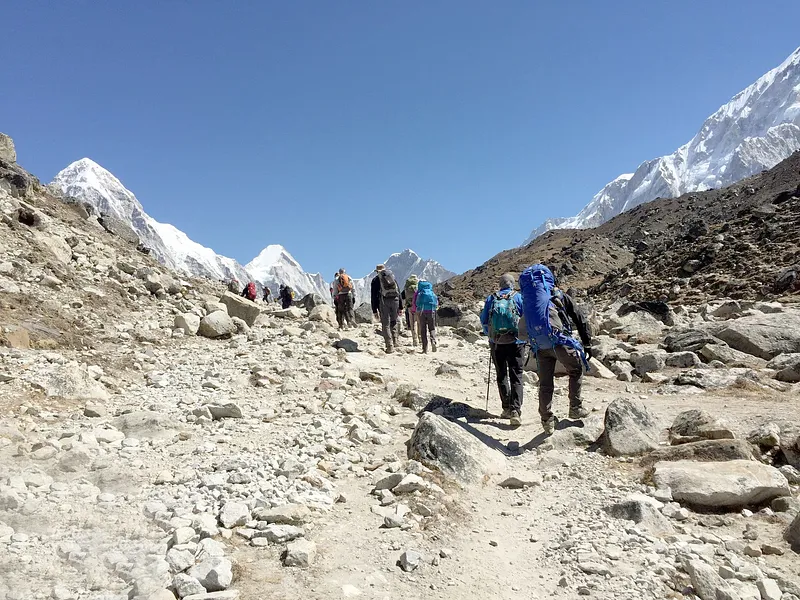
Days follow stone trails, suspension bridges and yak paths; nights centre on teahouses where altitude, weather and mountain views set the rhythm.

Tenzing-Hillary Airport

Lukla

Tenzing-Hillary Airport

The 527-metre runway sits at 2,845 metres and serves as Khumbu’s principal trekking gateway.

Namche Bazaar Amphitheatre

Namche Bazaar

Namche Bazaar Amphitheatre

This Sherpa trading town curves across a mountainside at approximately 3,440 metres.

Khumjung

Khumjung Monastery

The Buddhist monastery stands in a Sherpa village beneath the 6,608-metre Khumbila peak.

Tengboche Monastery

Tengboche

Tengboche Monastery

Khumbu’s largest monastery, rebuilt after a 1989 fire, faces Ama Dablam and Everest.

Namche Bazaar

Namche Bazaar

Namche Bazaar

This amphitheatre-shaped Sherpa town at 3,440 metres is the Khumbu’s main trading and acclimatisation centre.

Sagarmatha National Park

Solukhumbu

Sagarmatha National Park

The 1,148-square-kilometre UNESCO-listed park contains Everest, glaciers and high-altitude Sherpa settlements.

Kala Patthar

Gorak Shep

Kala Patthar

The 5,545-metre viewpoint provides a close panorama of Everest, Nuptse and the Khumbu Glacier.

Everest Base Camp

Khumbu Glacier

Everest Base Camp

The seasonal expedition camp stands near 5,364 metres beside the shifting Khumbu Icefall.

Gokyo Lakes

Gokyo

Gokyo Lakes

Six glacial lakes lie between 4,700 and 5,000 metres within Sagarmatha National Park.

On the table

Food & culture

  • Walk clockwise around stupas, mani stones and prayer wheels.
  • Ask permission before photographing monks, ceremonies or village residents.
  • Use the right hand when giving money or accepting food.
  • Keep voices low inside Tengboche and Khumjung monasteries.

Plan

Plan Your Journey

Things to do

  • Hike from Namche Bazaar to the Everest View Hotel lookout
  • Attend morning prayers at Tengboche Monastery when access is permitted
  • Cross the Hillary Suspension Bridge above the Dudh Koshi
  • Walk beside the Khumbu Glacier to Everest Base Camp
  • Climb Kala Patthar before sunrise for Everest views
  • Visit Khumjung village and learn about Sherpa community life

Getting there and how long to stay

twelve to sixteen nights for the classic high-Khumbu route is what the place is worth — not how long our trips happen to run.

Most trips fly from Kathmandu or, during peak operations, Manthali in Ramechhap to Tenzing-Hillary Airport at Lukla. Manthali requires a road transfer from Kathmandu, commonly before dawn. Weather delays affect Lukla flights. The slower overland alternative reaches Salleri by road and continues towards Khumbu on foot.

Getting around

Travel within Khumbu is mainly on foot along stone paths, suspension bridges and marked mountain trails. Porters, yaks and zopkios carry supplies; animals should be passed on the uphill side. There is no practical road network linking the main trekking valleys. Helicopters operate for transfers and evacuations when weather permits.

Who it suits

  • High-altitude trekkers Tea-house trails connect Everest Base Camp, Gokyo and three major passes without requiring a camping expedition.
  • Mountain photographers Ama Dablam, Everest, Gokyo Lakes and dawn from Kala Patthar create distinct high-Himalayan compositions.
  • Mountaineering-history travellers Namche, Khumjung and Everest Base Camp connect the 1953 ascent story with today’s expedition economy.
  • Buddhist culture travellers Tengboche and Pangboche preserve Sherpa monastic life within an inhabited high-altitude landscape.
Currency
NPR
Dialling code
+977

Emergency numbers

100 Nepal Police
101 Fire service
102 Ambulance
1144 Tourist Police

Your trip manager confirms embassy contacts and local numbers for your own route before you travel — these change by state and city.

Visa and entry rules depend on your passport. Ask us what you'll need.

Questions, answered

When is the best time to visit the Everest Region?
September to December offers the clearest mountain views and generally stable trekking conditions. December is colder, especially above Namche Bazaar.
Do Indian passport holders need a Nepal visa?
No. Indian citizens enter Nepal visa-free using a valid Indian passport or original Election Commission voter ID.
Which languages are commonly spoken?
Nepali is official, Sherpa is common in Khumbu communities, and trekking staff generally speak functional English and Hindi.
Is the Everest Region safe for trekking?
Trails are established, but altitude sickness, sudden weather and flight disruption are serious risks. Acclimatisation, insurance and experienced guides reduce exposure.
What should be packed for the Everest Region?
Pack layered clothing, broken-in trekking boots, sun protection, personal medicines and a cold-rated sleeping bag. Winter departures require heavier insulation.
Who should be contacted during an emergency?
Call Nepal Police on 100, ambulance services on 102 or Tourist Police on 1144. Mountain evacuations usually require an insurer-approved helicopter.

Get ready

Take this

  • Layered moisture-wicking clothing
  • Broken-in waterproof trekking boots
  • Warm hat and insulated gloves
  • UV sunglasses and high-SPF sunscreen
  • Personal medicines and basic first-aid supplies
  • Passport or original Indian voter ID
  • NPR cash in small denominations
  • Reusable water bottle and purification method

You may need this

  • Cold-rated sleeping bag for higher villages
  • Down jacket for late autumn and winter
  • Waterproof shell and rain trousers
  • Trekking poles for steep descents
  • Microspikes after snow or ice
  • Altitude medication prescribed by a doctor
  • Duffel bag for porter-carried luggage

Don't forget

  • Travel insurance covering high-altitude helicopter evacuation
  • Headlamp with spare batteries
  • Power bank carried in cabin baggage
  • Type C, D or M plug adapter
  • Printed permits and insurance details
  • Offline maps and emergency contacts
  • Spare passport photographs

Check before flying

Baggage allowances, liquids, power banks and battery rules differ by airline and by route, and they change. We publish them here only once we have checked them against the airline's own page — until then, check your airline directly, and your trip manager will confirm anything unusual on your route.

Practical reference

Your time

7:11 PM

Asia/Kolkata

In Everest Region

7:26 PM

Asia/Kathmandu

Currency
NPR (Rs.)

ISO 3166 / 4217

Worth in rupees
Rs.1 ≈ ₹0.63

our live FX feed · updated about 16 hours ago

Official languages
Nepali

ISO 3166 / 4217

Time zone
Asia/Kathmandu

IANA time zone database

Ahead of India
0h 15m ahead

IANA time zone database

Plugs, SIM cards, tipping and embassy contacts are not here yet — we will not publish those until each one is verified against an official source. Your trip manager has them for your route in the meantime.

Still deciding

Ask about Everest Region

Answered from everything on this page. For anything it cannot answer, a real trip manager will.

Try: “Which month should I visit?” · “How much should I budget?” · “What should I pack?” · “What food should I try?”